








Select NOAA-NWS Forecast Office Text Products
(Product availability varies with seasons, forecast office, and weather.)
Hazardous Weather Outlook for Buffalo, NY
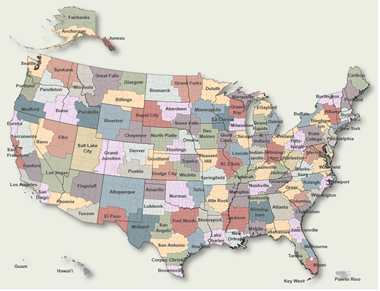
To Select Another NWS Office Click on Map or Choose from List
|
| Select Forecast Office: | Select Product: |
628 FLUS41 KBUF 200548 HWOBUF Hazardous Weather Outlook National Weather Service Buffalo NY 148 AM EDT Sun Sep 20 2026 NYZ001>008-010>014-019>021-085-210600- Niagara-Orleans-Monroe-Wayne-Northern Cayuga-Oswego-Jefferson-Lewis- Northern Erie-Genesee-Wyoming-Livingston-Ontario-Chautauqua- Cattaraugus-Allegany-Southern Erie- 148 AM EDT Sun Sep 20 2026 This Hazardous Weather Outlook is for western and north central New York. .DAY ONE...Today and tonight. No hazardous weather is expected at this time. .DAYS TWO THROUGH SEVEN...Monday through Saturday. No hazardous weather is expected at this time. .SPOTTER INFORMATION STATEMENT... Spotter activation is not expected at this time. This product, along with other watches, warnings, advisories, and statements issued by the National Weather Service office in Buffalo can be found on the internet at http://www.weather.gov/buf $$ LEZ040-041-LOZ042>045-062>065-210600- Lake Erie nearshore waters from Ripley to Dunkirk- Lake Erie nearshore waters from Dunkirk to Buffalo- Lake Ontario nearshore waters from the Niagara River to Hamlin Beach- Lake Ontario nearshore waters from Hamlin Beach to Sodus Bay- Lake Ontario nearshore waters from Sodus Bay to Mexico Bay- Lake Ontario nearshore waters from Mexico Bay to the Saint Lawrence River- Lake Ontario open waters from the Niagara River to Hamlin Beach- Lake Ontario open waters from Hamlin Beach to Sodus Bay- Lake Ontario open waters from Sodus Bay to Mexico Bay- Lake Ontario open waters from Mexico Bay to the Saint Lawrence River- 148 AM EDT Sun Sep 20 2026 This Hazardous Weather Outlook is for portions of Lake Erie and Lake Ontario. .DAY ONE...Today and tonight. No hazardous weather is expected at this time. .DAYS TWO THROUGH SEVEN...Monday through Saturday. No hazardous weather is expected at this time. .SPOTTER INFORMATION STATEMENT... Spotter activation is not expected at this time. This product, along with other watches, warnings, advisories, and statements issued by the National Weather Service office in Buffalo can be found on the internet at http://www.weather.gov/buf $$ LEZ020-LOZ030-210600- Upper Niagara River and Buffalo Harbor-Lower Niagara River- 148 AM EDT Sun Sep 20 2026 This Hazardous Weather Outlook is for portions of Lake Erie and Lake Ontario. .DAY ONE...Today and tonight. No hazardous weather is expected at this time. .DAYS TWO THROUGH SEVEN...Monday through Saturday. No hazardous weather is expected at this time. .SPOTTER INFORMATION STATEMENT... Spotter activation is not expected at this time. This product, along with other watches, warnings, advisories, and statements issued by the National Weather Service office in Buffalo can be found on the internet at http://www.weather.gov/buf $$ SLZ022-024-210600- Saint Lawrence River from Cape Vincent to Ogdensburg- Saint Lawrence River from Ogdensburg to Saint Regis- 148 AM EDT Sun Sep 20 2026 This Hazardous Weather Outlook is for the New York waters of the Saint Lawrence River. .DAY ONE...Today and tonight. No hazardous weather is expected at this time. .DAYS TWO THROUGH SEVEN...Monday through Saturday. No hazardous weather is expected at this time. .SPOTTER INFORMATION STATEMENT... Spotter activation is not expected at this time. This product, along with other watches, warnings, advisories, and statements issued by the National Weather Service office in Buffalo can be found on the internet at http://www.weather.gov/buf $$ |
Previous Hazardous Weather Outlooks may be found at
NWS Buffalo, NY (BUF) Office Hazardous Weather Outlooks.
(Click 'Previous Version' there to view past versions successively.
Some may differ only in time posted.)
Products Courtesy of NOAA-NWS
NWS Information Parsing Script by Ken True at Saratoga Weather - WFO and Products Scripts by SE Lincoln Weather.
Mapping by Curly at Michiana Weather and by Tom at My Mishawaka Weather.